

After the 7.8 magnitude earthquake struck the city of Nurdagi of Gaziantep Province in southern Turkey on Monday, the Changsha-based Spacety Co Ltd immediately arranged the Chaohu-1 satellite to conduct emergency imaging of the earthquake zone, the Global Times reporters learned on Tuesday. The radar remote sensing images of the surrounding area of the epicenter were obtained at 11:05 am local time on Monday.
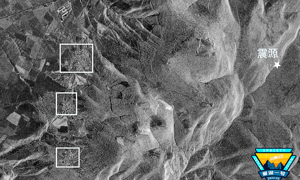
Satellite image taken by Chaohu-1. (Photo: Courtesy of Spacety)
After the earthquake first jolted the area, at least 185 aftershocks have been recorded in the southeast of the country and surrounding areas. With the situation in the disaster zone unclear and aftershocks continuing, remote sensing satellites have become the main means of obtaining information on the earthquake, experts said.
According to Spacety China, the Chaohu-1 satellite adopts a strip mode, with an imaging area covering about 8,878 square kilometers. Researchers from the company compared the images of the epicenter with previously published optical satellite images before the earthquake. A residential area about three kilometers from the epicenter was apparently damaged.
More than 2,000 deaths and thousands more injuries have been reported as of the press time following the earthquake, reports said.
The Global Times learned that the weather in the epicenter of the earthquake was inclement with thick clouds surrounding the area, which made it difficult for optical satellite imaging. The company's synthetic aperture radar, which can work all day and in all conditions, is an important means to obtain the panoramic images of the quake-stricken area. Spacety will continue to follow the situation in the earthquake zone and provide satellite image support for the relief work in the quake-hit areas, the company said.