


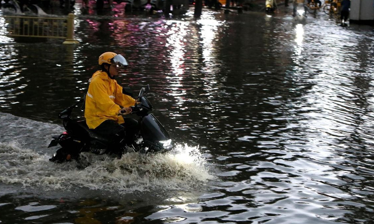
A delivery rider travels through a waterlogged street after heavy rainfall occurred in Xi'an, Northwest China's Shaanxi Province. (Photo: VCG)
Extreme weather warnings were issued across multiple parts of China on Sunday, with heavy rainfall and extreme heat sweeping across multiple regions, amid a developing super El Nino event which, combined with typhoons and monsoon activity, has altered atmospheric circulation patterns over southern China and could become one of the strongest such events in 150 years.
According to the China Meteorological Administration (CMA), the El Nino climate phenomenon currently strengthening across the Pacific Ocean is developing along an unusual trajectory, with experts saying its formation mechanism is highly atypical, per CCTV News.
El Nino refers to a climate phenomenon characterized by persistent abnormal warming of sea surface temperatures in the equatorial central and eastern Pacific. It typically peaks toward the end of the year, experts said. However, monitoring data from CMA shows that the equatorial central and eastern Pacific had already reached El Nino conditions in May, with sea surface temperatures continuing to rise in June. By July, the event had entered the monitoring phase for a strong El Nino, while the likelihood of an extremely strong El Nino event has continued to increase.
The CMA estimates that the current El Nino event will continue at least until next spring, with its overall duration expected to be close to the historical average length of El Nino events — around 10 to 11 months, per CCTV News.
However, experts cautioned that uncertainty remains over how strong the El Nino event will ultimately become.
Chen Lijuan, chief forecaster at the National Climate Center, said historical data shows that El Nino affects China's climate differently during its development, peak and decline phases.
Generally, during the summer of an El Nino development year, more typhoons form over the northwestern Pacific, with stronger intensity and formation locations shifting southeastward. Typhoons making landfall in China tend to be stronger, bringing greater impacts to southeastern and southern coastal areas. Some systems may also move northward and affect broader regions.
During the autumn and winter when El Nino reaches its peak, rainfall in southern China tends to increase significantly. In the spring and summer following El Nino's decline, flood risks are higher in the Yangtze River basin and the Jiangnan region.
If a strong El Nino event develops, the western Pacific subtropical high is likely to shift farther west and become stronger. This could transport more warm, moist air from the southern seas toward China's inland areas. When this moisture-laden air meets cold air moving southward from the north, it can trigger frequent heavy rainfall and lead to extreme weather events in some regions, Zhao Tao, chief forecaster at the National Meteorological Center, told the Global Times on Sunday.
Weather alerts have been issued across China for places including North China's Shanxi Province, Central China's Hubei Province, Southwest China's Sichuan Province, and South China's Guangdong Province.
The National Meteorological Center (NMC) issued an orange alert for heavy rain on Sunday, with affected regions including Sichuan, Chongqing, Inner Mongolia, Shaanxi, and Guangdong. The Ministry of Water Resources on Sunday activated a Level IV flood emergency response for Chongqing, and Sichuan has already relocated 64,609 people in advance as a precaution, following recent accumulations of heavy rainfall. Guangdong issued heavy rainfall defense alerts for four cities, while Inner Mongolia also issued a yellow alert for severe convective weather.
Behind these events, El Nino acts as a global climate "amplifier" by altering the probability of extreme heat, drought and heavy rainfall. Strong El Nino events can reshape atmospheric circulation patterns through atmospheric teleconnections and ocean-atmosphere interactions, influencing seasonal climate patterns in different regions, Zhang explained.
According to the WMO Global Annual to Decadal Climate Update (2025-2029), global average temperatures are likely to remain at historically high levels or close to record highs between 2026 and 2030.
Zhang said that based on historical observations and expert analysis, the global climate impact of a strong El Nino event often reaches its maximum intensity in the following year. Therefore, from next spring through summer, the El Nino impacts may further intensify.