


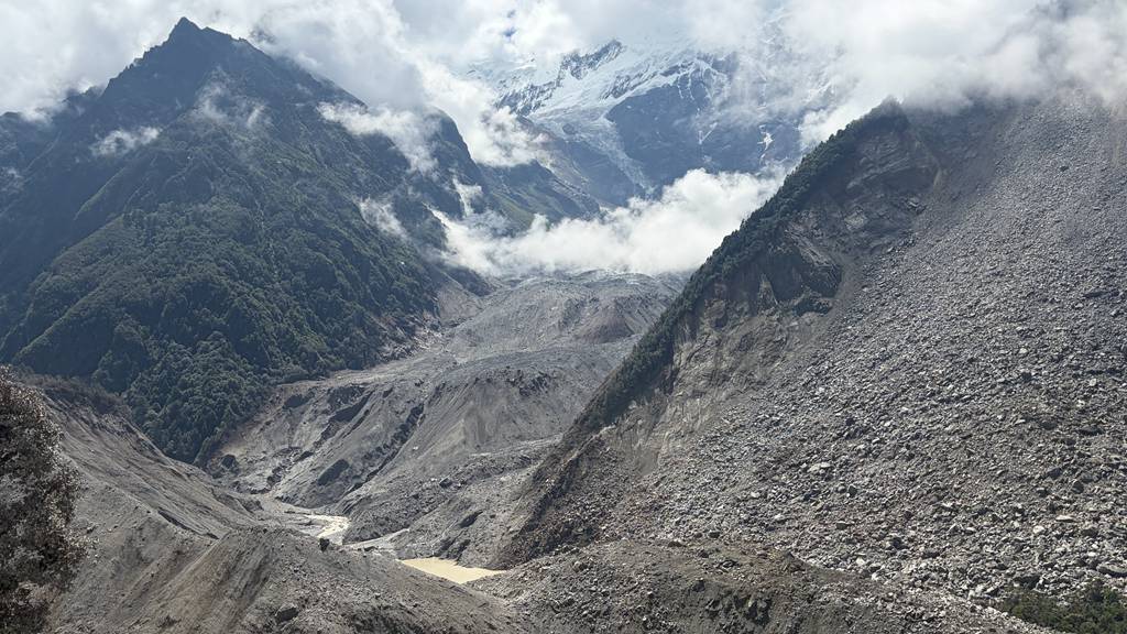
The barrier lake near Gyirong Port in southwest China's Xizang Autonomous Region, August 28, 2026. Gong Ming/CGTN
The devastating mudslides that swept through parts of Nepal and southwest China's Xizang Autonomous Region on Wednesday may have originated high in the Himalayas, with the sudden collapse of a large glacier potentially marking the beginning of a chain of cascading hazards.
But scientists caution that it is still far too early to draw definitive conclusions. The disaster is still under investigation, and researchers are working to reconstruct exactly what happened – and what ultimately caused the ice and surrounding mountain slopes to become unstable.
What is becoming increasingly clear is that this may not have been a single event, but a series of hazards that interacted with and amplified one another.
The trigger: a glacier collapse
Satellite observations, combined with preliminary analysis by Chinese geological experts, suggest that a high-altitude glacier in Nepal collapsed on Wednesday.
A large mass of ice appears to have broken apart at an elevation of more than 5,000 meters and surged down a steep mountain slope.
And it was not just ice that came down.
As the mass raced downhill, it acted like a giant bulldozer, scouring up rocks, loose sediment and other debris along the way. What began as a glacier collapse may have rapidly transformed into a high-speed mixture of ice, rock and sediment – a process known as an ice-rock avalanche.
Huge amounts of ice and rock debris then entered a mountain river channel, picking up more water and sediment along the way.
In this way, what may have begun as a relatively localized collapse high in the mountains could have developed into a much larger disaster downstream.
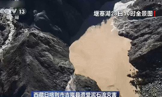
An aerial view of the barrier lake which formed near Gyirong Port in southwest China's Xizang Autonomous Region, August 28, 2026. /VCG
Was climate change to blame?
This is where scientists need to be particularly cautious.
It is too early to say that climate change directly caused this particular glacier collapse.
Researchers first need to identify the immediate trigger that destabilized the glacier and surrounding mountain. The potential factors are complex: changes within the glacier itself, meltwater entering cracks in the ice or underlying rock, the inherent stability of the surrounding slopes, recent weather conditions and local geological processes could all have played a role.
But on a much broader timescale, scientists are increasingly concerned about the deeper influence of climate change.
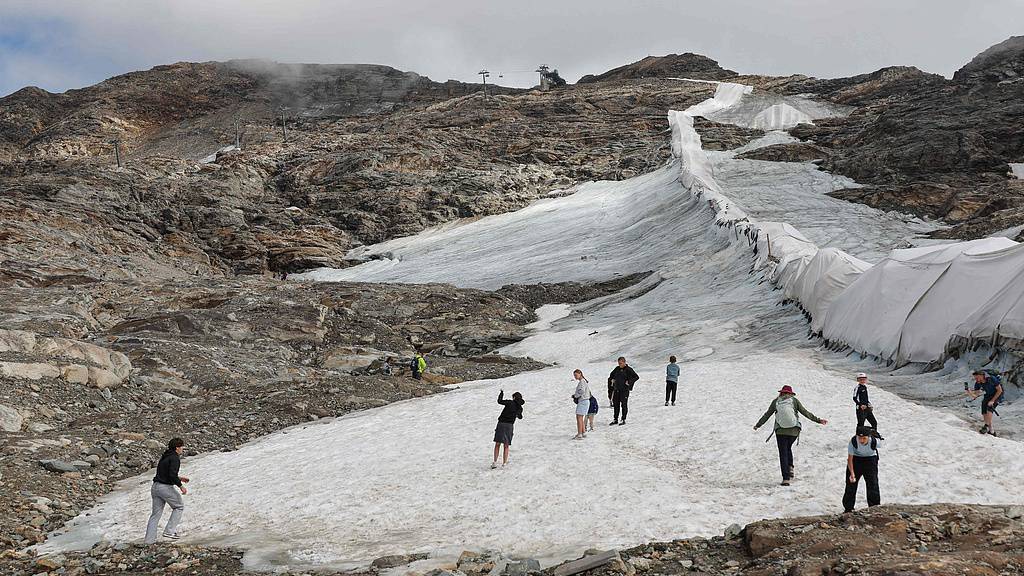
People walk beside protective fleece covering part of the Moelltal Glacier in Carinthia, Austria, on August 19, 2026, as the glacier has shrunk to a narrow strip of snow amid accelerating ice loss across the Alps, where glacier surface area has fallen 39% since 2000. (Photo: VCG)
Global warming is reshaping the relationships between glaciers, permafrost, rock and water in high-mountain environments.
Rising temperatures can cause glaciers to retreat and permafrost to thaw. They can also alter the conditions that help keep ice and mountain slopes stable.
As glaciers retreat, they can leave behind unstable slopes and glacial lakes. Meltwater can also penetrate cracks in ice and rock, potentially weakening them.
But none of this means that every glacier collapse can simply be attributed to global warming.
A more accurate way to put it is this: Climate change may be altering the background conditions that shape the risk of hazards in high mountains. But whether it was the direct trigger for this particular event remains unknown.
Why did an ice-rock avalanche become such a devastating disaster?
The extreme topography of the Himalayas is part of the answer.
Over a very short horizontal distance, the region can experience enormous changes in elevation.
A glacier or mountain collapse occurring thousands of meters above sea level can accelerate rapidly as it travels down a steep valley. In this case, the debris flow triggered by the high-altitude ice avalanche traveled approximately 20 kilometers in just seven minutes before evolving into a mudflow that struck Gyirong Port.
And a disaster can change character as it moves downstream.
Ice can rapidly break apart. Rocks and sediment can be incorporated into the flow. Water can be added along the way.
The result can evolve into a debris flow and, in some areas, a sudden flood, carrying a mixture of water, mud, rocks and ice far beyond the original point of collapse.
An important scientific lesson
The disaster is a reminder that in the Himalayas – and potentially in mountain regions around the world – we may need to look beyond individual hazards and pay greater attention to how different hazards interact and amplify one another.
A glacier is not simply melting.
Changes in a glacier can affect the stability of a mountain slope. A destabilized slope can trigger an ice-rock avalanche. That avalanche can evolve into debris flows and floods downstream.
Scientists refer to that as a multi-hazard cascade. And that may be one of the most important scientific lessons from this disaster.
For now, however, every conclusion needs to remain provisional.
The evidence increasingly points to a high-altitude glacier or ice-rock collapse as a possible starting point for the disaster chain. But scientists are still trying to determine exactly what destabilized the mountain, how the ice and debris flow evolved as it moved downstream, and what roles – if any – recent weather, local geological conditions and long-term climate change played.
In a Himalayas that is warming and remains highly dynamic, answering these questions is not only about understanding what happened yesterday.
It may also help us detect, warn about and respond to the next high-mountain disaster before it reaches the communities downstream.
(Ouyang Chaojun, researcher at the Institute of Mountain Hazards and Environment, Chinese Academy of Sciences, contributed to this story.)