


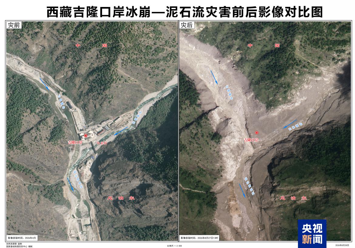
Before-and-after imagery comparison of the ice avalanche and mudslide disaster at Gyirong Port, southwest China's Xizang Autonomous Region. /CMG
China's Ministry of Natural Resources has released three-dimensional imagery showing the area around Gyirong Port in southwest China's Xizang Autonomous Region before and after a major mudslide, offering a detailed view of the disaster's source, path and impact.
The imagery shows that the mudslide caused extensive damage around Gyirong Port, with buildings, roads and bridges visible in pre-disaster imagery no longer identifiable in post-disaster images.
According to Guo Zhaocheng, a professor-level senior engineer at the China Aero Geophysical Survey and Remote Sensing Center, the ice-avalanche debris flow traveled downstream along the Donglin Tsangpo River before reaching Gyirong Port, where it struck buildings and infrastructure.
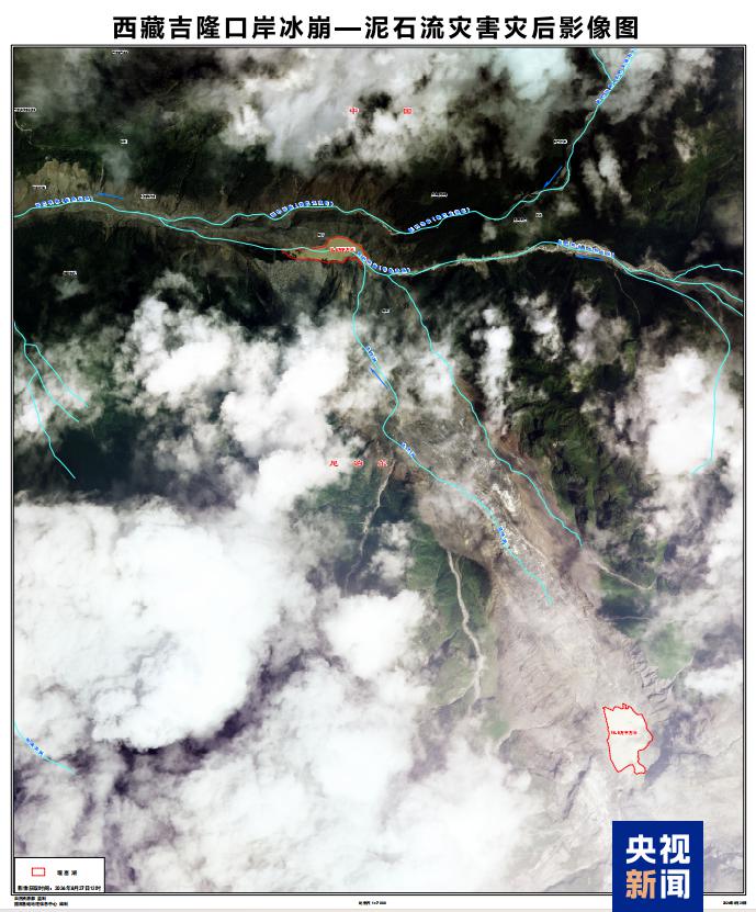
Post-disaster imagery of the ice avalanche and mudslide at Gyirong Port. /CMG
Where did the mudslide come from?
Experts confirmed the source of the disaster lies in Nepal, not on the Chinese side of the border.
According to Guo, a high-altitude glacier in the upper reaches of the Cuoqian River in Nepal collapsed at an elevation of around 5,140 meters. The collapse sent ice and rock debris rushing downhill, scouring and entraining loose deposits along the gully and forming a high-speed debris flow.
The debris flow then entered the Guobaxiaqu River, a boundary river between China and Nepal, before joining the Donglin Tsangpo. It subsequently moved downstream along the river channel and evolved into a large-scale mudslide that struck Gyirong Port and continued toward downstream areas in Nepal.
The disaster is a cascading event: it starts with a high-altitude ice collapse, develops into a debris flow, and finally grows into a massive mudslide.
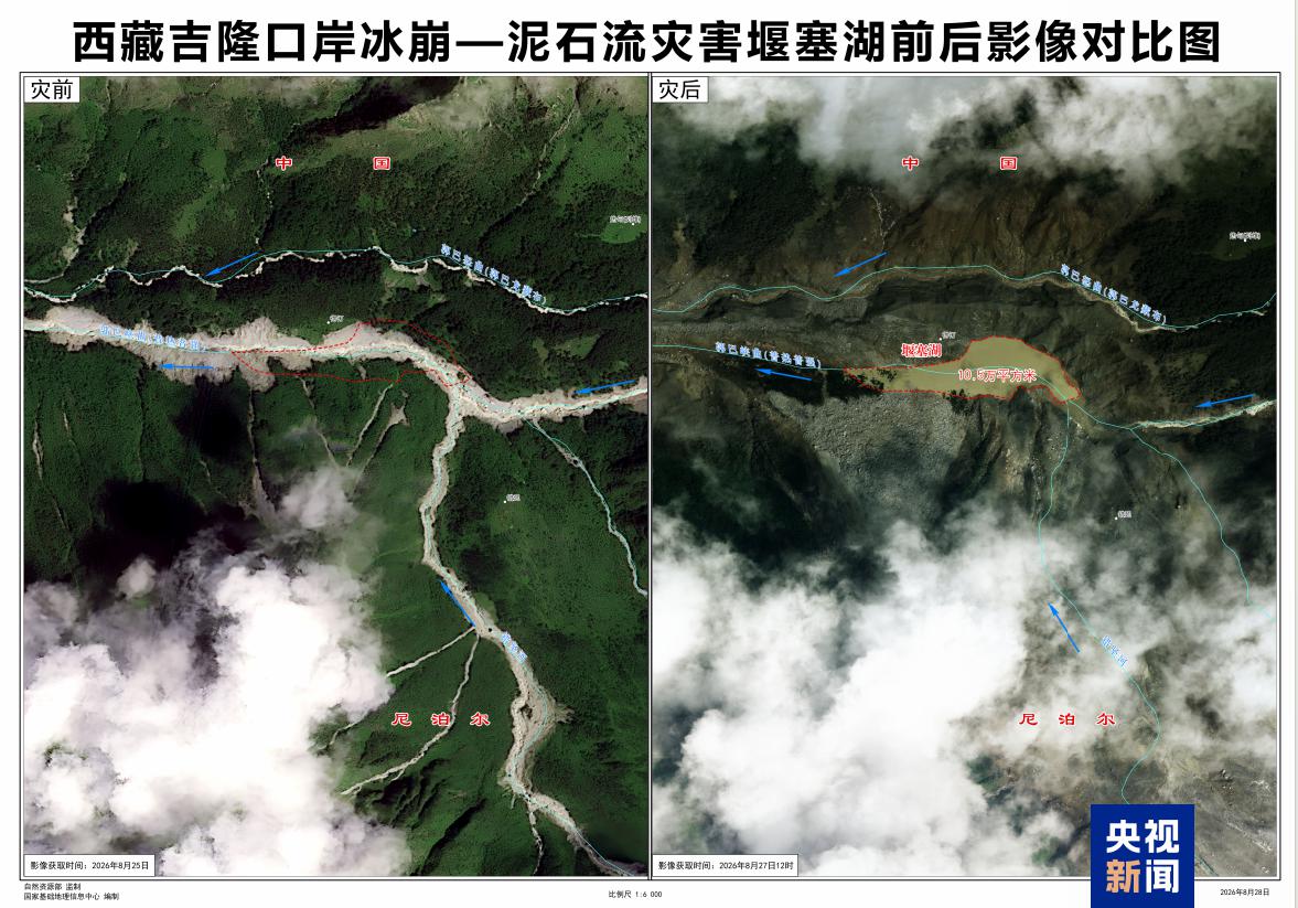
Before-and-after imagery comparison of the barrier lake formed by the ice avalanche and mudslide. /CMG
How fast and how far did the debris flow travel?
Experts said the drastic elevation difference between the source area and Gyirong Port accounts for the extreme speed of the debris flow.
The source area in the upper Cuoqian River sits at about 5,140 meters above sea level, while Gyirong Port is at an elevation of around 1,800 meters. That creates an elevation drop of nearly 3,300 meters over a distance of about 20 kilometers.
Based on available time records, Guo said the glacier collapse began at around 10:52 a.m. on August 26, and video footage showed the mudslide reaching Gyirong Port at around 10:59 a.m.
That means the debris flow traveled nearly 20 kilometers in about seven minutes, with an estimated average speed of around 50 meters per second. Guo noted the speed was extraordinarily high, leaving people almost no time to react.
Beyond its extreme speed, the debris flow also produced a rare phenomenon after slamming into the main river channel at Gyirong: part of the flow traveled upstream against the river current. Analysis of the 3D imagery shows the mudslide flowed nearly 3 kilometers upstream in the Gyirong Tsangpo River.
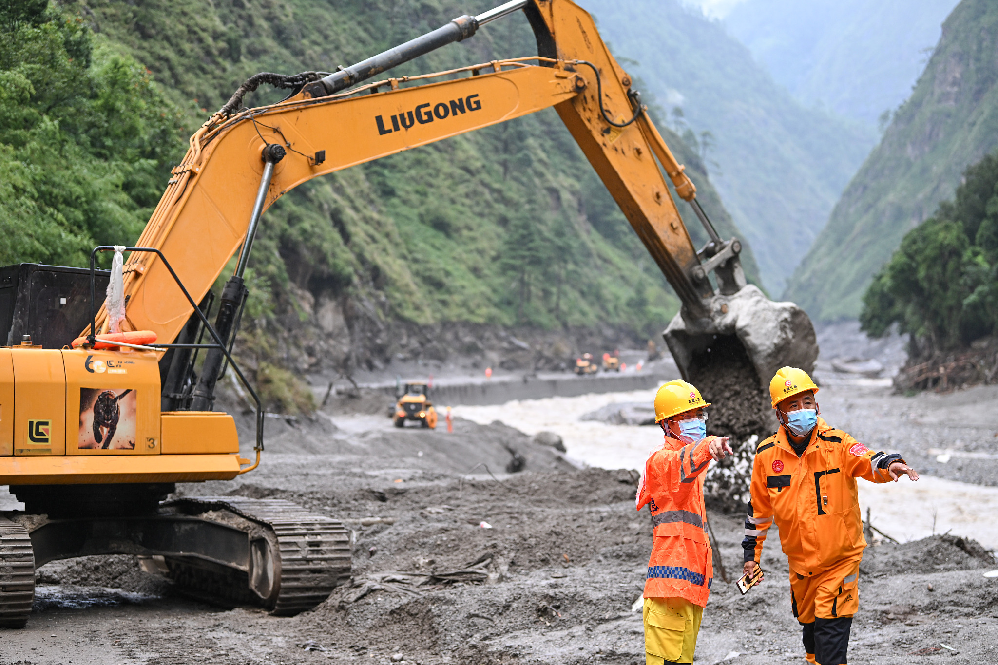
Excavators, loaders and other heavy machinery work to clear debris and restore access along a disaster-hit road in Gyirong County, August 28, 2026. /VCG
Why is the rescue operation difficult?
Experts said damage to transport infrastructure, steep terrain and vast amounts of debris have severely complicated search and rescue efforts.
The section of National Highway G216 affected by the mudslide has been damaged, making vehicle access to some areas extremely difficult. Rural roads running along the Donglin Tsangpo valley downstream from Gyirong Port were also completely washed out, blocking both vehicle and pedestrian access.
The narrow, steep gully terrain provides limited space for deploying rescue personnel and equipment. Meanwhile, the force of the mudslide carried some buildings and infrastructure far downstream, making their locations hard to pinpoint. Thick layers of mud covering the disaster zone also make identification and search work more challenging.
Search and rescue operations are continuing, with multiple teams using drones, detection equipment and other technologies to survey the disaster area. Chinese authorities have also deployed professional geological and engineering teams to assess the surrounding terrain and potential secondary hazards.