


China and Nepal join forces in cross-border disaster response
On the morning of August 26, Gyirong Port in Gyirong county, Southwest China's Xizang Autonomous Region, was hit by a severe landslide that occurred on the Nepalese side of the border.
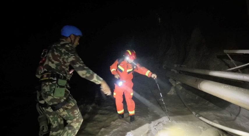
A Chinese tunnel-rescue expert (right) works with Nepalese personnel on a search-and-rescue operation in Nepal's disaster-hit area. (Photo courtesy of the Chinese tunnel-rescue expert team)
In the aftermath, Chinese authorities in meteorology, water resources and natural resources swiftly coordinated with their Nepalese counterparts. They shared real-time monitoring data and provided meteorological and hydrological products and services to support joint disaster relief operations.
Located on the Qinghai-Tibet Plateau, Gyirong Port is characterized by high elevation, complex terrain and highly variable weather conditions.
"From late August to early September this year, cold air has been particularly active across the plateau, especially along the border areas. This has led to frequent precipitation and posed severe challenges to rescue efforts," explained Ma Xuekuan, chief forecaster at the National Meteorological Center.
"At noon on August 26, after receiving a request from Nepal's Department of Hydrology and Meteorology, we organized the first joint consultation that same afternoon. On the afternoon of August 31, we held a second joint consultation with the Nepalese side," said Zhang Tianhang, a senior engineer at the World Meteorological Center Beijing. The two sides had previously set up a WeChat working group to share relevant information in real time.
The emergency consultation on August 26 was conducted via MAZU, a multi-hazard, alert, zero-gap and universal cloud-based meteorological early warning system. Experts from both sides jointly assessed weather conditions and analyzed the trajectory of subsequent precipitation.
The China Meteorological Administration (CMA) subsequently set up a dedicated task force to provide ongoing meteorological support for Nepal, issuing a daily English-language briefing on meteorological monitoring and forecasting information.
For real-time monitoring, the briefings include infrared cloud imagery from China's Fengyun meteorological satellites, as well as products showing current temperatures and precipitation around the disaster-affected area at a spatial resolution of 1 kilometer. At the request of the Nepalese side, the latest briefing also included lightning monitoring products based on Fengyun satellite data.
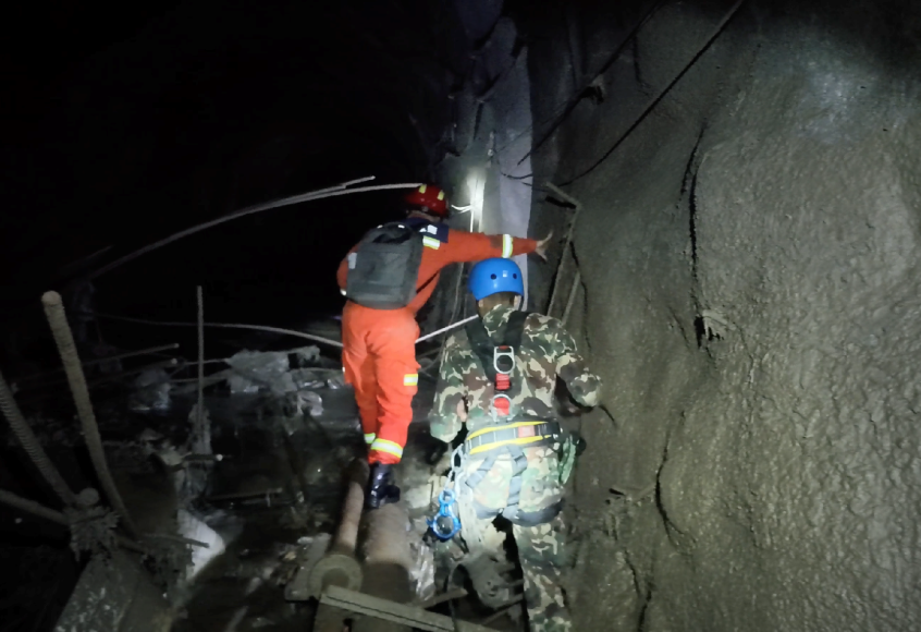
A Chinese tunnel-rescue expert (left) works with Nepalese personnel on a search-and-rescue operation in Nepal's disaster-hit area. (Photo courtesy of the Chinese tunnel-rescue expert team)
For forecasting, the CMA mainly provides seven-day weather forecasts for areas near the disaster site, also at a one-kilometer resolution, along with areal precipitation forecasts for the next three and seven days.
"In addition, we have continued to update extended-range forecasts covering 15 to 30 days. Overall, we have provided the Nepalese side with seamless forecasting services covering the next 30 days, offering strong support for its rescue efforts," Zhang said.
Following the disaster, a barrier lake formed near the confluence where the Cuojian River from Nepal meets the Purepuqiang Zangbo River on Chinese territory.
China's Ministry of Water Resources immediately dispatched an emergency hydrological monitoring team to the front line. Working alongside staff from the Xizang Bureau of Hydrology and Water Resources Survey, the team carried out hydrological monitoring, forecasting and early warning operations.
At present, the Ministry of Water Resources provides the Nepalese side with daily updates on the development status of the barrier lake on the Purepuqiang Zangbo River, potential chain reactions caused by impact craters along the Cuojian River and glacial lakes in the Gyirong Zangbo River basin. They also cover potential and newly formed barrier lakes, as well as hydrological emergency monitoring. The information provides strong support for emergency response and rescue efforts downstream on the Nepalese side.
Across Nepal, only 17 meteorological observation stations are shared with international organizations, resulting in insufficient observation coverage.
China has built the world's largest integrated, three-dimensional meteorological observation system incorporating space-, air- and ground-based capabilities. Its advanced observation equipment, including Fengyun meteorological satellites and weather radars, provides strong monitoring capabilities.
Following the disaster, the CMA immediately made arrangements to strengthen monitoring. On the evening of August 26, it deployed small ground-based observation stations around the disaster-affected area. On September 1, it deployed a mobile weather radar near the affected area.
To address gaps in Nepal's meteorological monitoring capabilities, the CMA also accelerated the development of a customized version of the MAZU platform for Nepal, completing it before the second joint consultation and continuously improving it in response to Nepalese needs. A large volume of meteorological monitoring products and observation data has since been shared with Nepal through the customized version of MAZU.
China's MAZU AI-powered meteorological early warning solution played an important role in the response to the disaster, providing timely support for Nepal's rescue efforts and earning a positive response from the Nepalese side. Nepal's Department of Hydrology and Meteorology sent a letter to the CMA expressing its appreciation.
Going forward, building on the sound cooperation between the two sides, China is willing to provide Nepal with meteorological equipment such as radars and ground observation stations to further strengthen the latter's meteorological observation capabilities and work with it to develop a one-stop early warning solution.
Following the disaster, the CMA also immediately activated its international user service response mechanism for Fengyun meteorological satellites, providing the disaster-affected area in Nepal with rapid-scan Fengyun satellite products featuring a spatial resolution of 250 meters and a temporal resolution of one minute, as well as multiple high-resolution forecasting products.
The China Aero Geophysical Survey and Remote Sensing Center for Natural Resources also coordinated the use of nearly 100 public-service and commercial satellites to scan the disaster-affected area and surrounding regions at high frequency. Experts rapidly assessed the location, causes and evolution, scope of impact and scale of the disaster and promptly released relevant information to the public.
A landslide may destroy homes, but it cannot break the bonds of solidarity and mutual assistance. The sharing of monitoring information and products has provided strong support for rescue efforts by both China and Nepal, demonstrating the two countries' determination to work together in responding to natural disasters and their shared hope of rebuilding homes.