


Satellites track glaciers for hazards in Xizang
Chinese commercial satellites are stepping up monitoring of glaciers upstream from Gyirong Port in the Xizang autonomous region, looking for cracks and surface shifts that could signal further hazards as rescue operations continue following the Aug 26 mudslide.
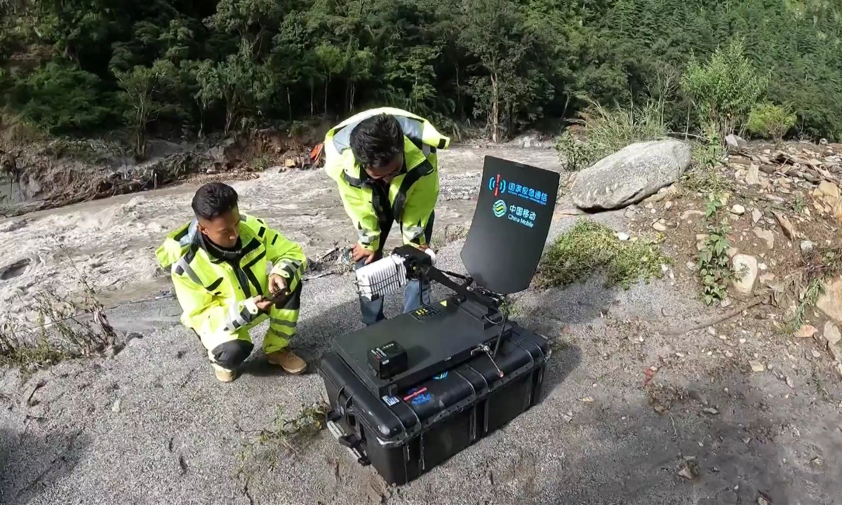
Telecommunications engineers deploy a mobile base station in disaster-hit Gyirong Port on the China-Nepal border in Southwest China's Xizang Autonomous Region on August 27, 2026. (Photo: VCG)
Three Synthetic Aperture Radar, or SAR, satellites operated by Spacety, a commercial aerospace company based in Changsha, Hunan province, are providing updated imagery to the rescue command center in Gyirong county, Shigatse. The satellites have already been used to monitor two barrier lakes and assess damage to National Highway G216 in the disaster-hit area.
The latest focus is the glacier area upstream, where the team is using satellite imagery to track changes in the ice surface and identify potential risks, said Jiang Lin, a satellite engineer with the company who is working at the front-line rescue command center.
"If we spot a potential risk, the data will be provided to the rescue command center for further ground-based checks," Jiang said. "By combining satellite technology with ground information, we have built a multilayered monitoring system to provide timely and accurate information for rescue operations."
The team has also introduced Interferometric Synthetic Aperture Radar, or InSAR, technology to improve its ability to detect surface deformation. By comparing radar images of the same area taken at different times, the technology can detect ground movement at the millimeter-to-centimeter scale and cover large areas without requiring monitoring equipment to be installed on the ground.
SAR technology is particularly useful in Gyirong's mountainous terrain as it can operate at night and penetrate clouds and rain that may obstruct optical satellite observations.
"Think of SAR satellites as CT scanners for the Earth," Jiang said. "As the satellite moves along its orbit, it actively transmits microwave signals to create high-resolution images, even in heavy rain or at midnight."
Spacety joined the emergency response shortly after the mudslide hit the Gyirong Port area. Within 20 minutes of receiving a request for support, the team adjusted its satellite imaging plans to prioritize the affected area, Jiang said.
The first SAR images were obtained in the early hours of Aug 27. Jiang and his colleagues arrived at the rescue command center later that day to coordinate satellite observations with the needs of teams on the ground.
Satellite imagery obtained on Aug 27 and Aug 28 identified two barrier lakes, helping rescuers assess potential flooding risks downstream. In SAR images, water surfaces appear dark, while debris and damaged slopes appear brighter, allowing analysts to identify the lakes and assess their extent, Jiang said.
The satellites have also captured damaged sections of National Highway G216 near Gyirong Port, providing imagery of road-clearing routes and excavation work.
With three satellites passing over the affected area at different times and from different angles, the team can repeatedly update observations of key sites, providing rescuers with a more complete picture of changing conditions.
"By working here with the frontline rescue teams, we can understand their needs firsthand and respond as quickly as possible," Jiang said. "We aim to bridge the last mile between space technology and rescue operations."