


Four new Chinese sites added to World Heritage Irrigation Structures list
Four Chinese irrigation projects have been added to the World Heritage Irrigation Structures (WHIS) list, bringing the country's total number of recognized sites to 46.
The 2026 WHIS list was officially announced at the 77th International Executive Council Meeting of the International Commission on Irrigation and Drainage (ICID) in Marseille, France, on Wednesday. All four China-nominated irrigation projects were successfully selected.
The four newly recognized sites are the Guangli Canal of the Qinhe River in central China's Henan Province, the Taolai River Oasis Irrigation System in northwest China's Gansu Province, the Huangsha Canal in Guangxin, Shangrao City, east China's Jiangxi Province, and the Longjin Ancient Weir Irrigation Project in southeast China's Fujian Province.
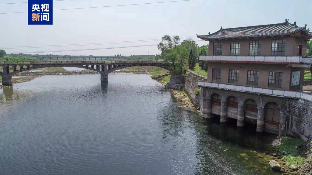
The headworks of the Guangli Canal. (Photo: CMG)
The Guangli Canal on the Qinhe River was first built during the Qin Dynasty (221-206 BC), more than 2,200 years ago. It uses a multi-head diversion irrigation system that operates without a dam. It is also one of the few large irrigation districts in China that has preserved the main structural components of its water-diversion infrastructure dating back to the Ming Dynasty (1368-1644). It irrigates 510,000 mu (about 34,000 hectares) of farmland in the cities of Jiyuan and Jiaozuo, which are major grain-producing centers in Henan.
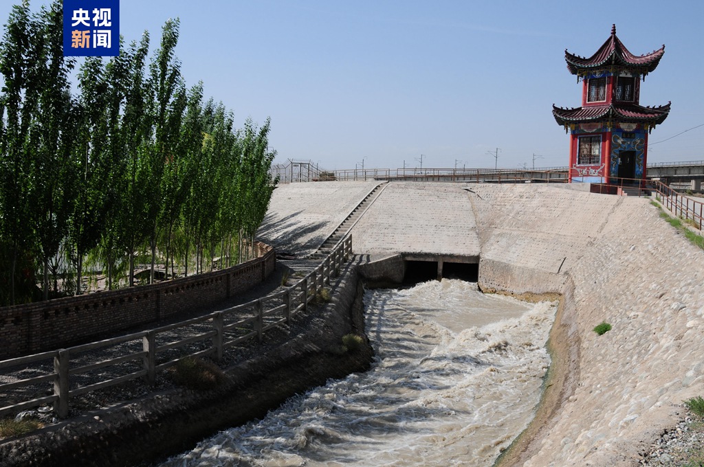
The intake of the north main canal of the Taolai River. (Photo: CMG)
The Taolai River Oasis Irrigation System is located in the central section of the Hexi Corridor in Gansu Province. Established during the Ming Dynasty, the system has a total irrigated area of 947,800 mu (about 63,187 hectares). It is a representative example of oasis irrigation systems in the arid regions of the Eurasian continent.
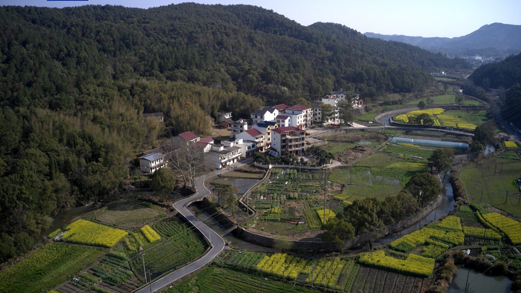
An aerial view of a branch canal of the Huangsha Canal. (Photo: CMG)
The Huangsha Canal, dating back to the Song Dynasty (960-1279), is a model of low-impact development in small mountainous watersheds in ancient China. The system adopts distributed, tiered development, constructing canals and small irrigation ponds from lower to higher elevations. It irrigates more than 10,000 mu (about 667 hectares) of farmland and nearly 10,000 mu of woodland.
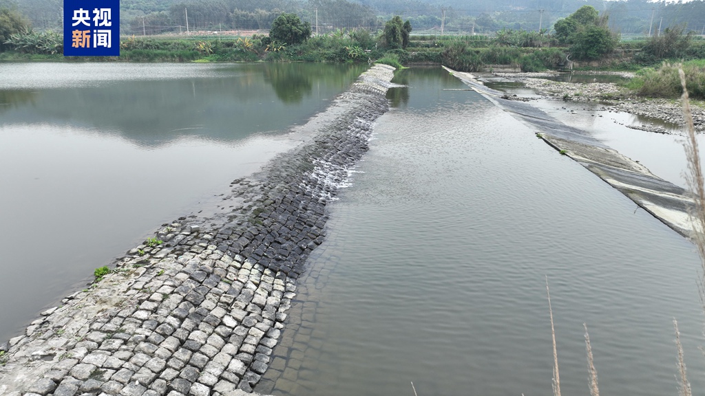
The river-diversion dam at the head of the Yanfu Canal of the Longjin Ancient Weir Irrigation Project. (Photo: CMG)
Located in Changtai District, Zhangzhou City, the Longjin Ancient Weir Irrigation Project was originally built during the Southern Song Dynasty more than 800 years ago. It is a typical example of the irrigation model used along mountain streams in China's southeastern coastal region, integrating water storage, water diversion and irrigation. It now irrigates 27,700 mu (about 1,847 hectares).