

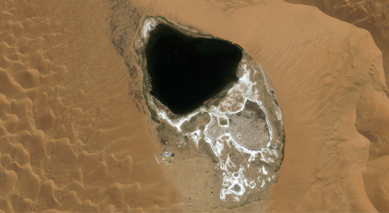
A photo taken by the Jilin-1 satellite shows a lake in the Badain Jaran Desert of Alshaa League of the Inner Mongolia autonomous region. (Photo by Changguang Satellite Technology for chinadaily.com.cn)
The satellite Jilin-1 recently sent back a series of images from space showing of lakes in various Chinese deserts.
The satellite family, developed by Changchun-based Changguang Satellite Technology Co, is China‘s first domestic remote-sensing satellite constellation for commercial purposes. It captures super high-definition images and helps with forest fire warnings, desertification, offshore rescue, ocean protection and other remote-sensing information services.
One of the areas photographed is the Badain Jaran Desert in Alshaa league, in the Inner Mongolia autonomous region — one of eight large deserts in China. It covers an area of 49,000 square kilometers and is arid, having annual precipitation of less than 40 mm. It is crisscrossed with faults exposing groundwater at the surface to form lakes in low-lying areas.
Magnificent lakes also exist in some other deserts, including the Tengger Desert in the Inner Mongolia autonomous region, the Mingsha Mountain in Dunhuang and the Jinta Desert in Jinta county, Gansu province.