

From January 23, all flights and train services out of Wuhan have been temporarily shut down. Buses and other public transport have also been suspended. Vehicles are not allowed in the central town without special permission. Citizens have since been avoiding crowds and unnecessary outdoor activities.
Take a look at these satellite pictures to get a sense of the changes the novel coronavirus outbreak has brought to Wuhan so far.
This animated graphic compares a typical satellite picture of Wuhan train station to one taken on January 31.
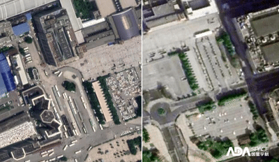
This animated graphic compares a typical satellite picture of Hankou train station to one taken on January 31
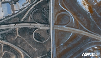
This animated graphic compares a typical satellite picture of the Wuhan 3rd Ring Road Overpass for Food Exchange to one taken on January 29.
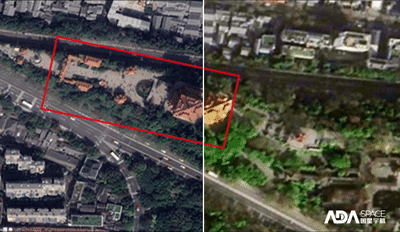
This animated graphic compares a typical satellite picture of Yellow Crane Tower, a famous tourist site in Wuhan, to one taken on January 31.
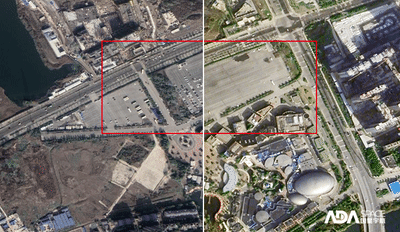
This animated graphic compares a typical satellite picture of Wuhan Hai Chang polar ocean park to one taken on January 31.
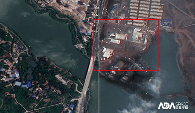
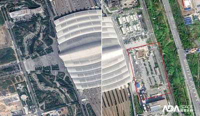
This animated graphic compares the view of Huoshenshan Hospital before construction to one taken on January 29 after construction. The design of the hospital was completed on January 24. The makeshift hospital, which will be able to accommodate up to 1,000 beds, is expected to go into operation by February 3.
This is a tough time, but we will get through it together.
(Compiled by Wang Jinhong)