

Keriya river in northwest China's Xinjiang
Xinhua
1574343728000
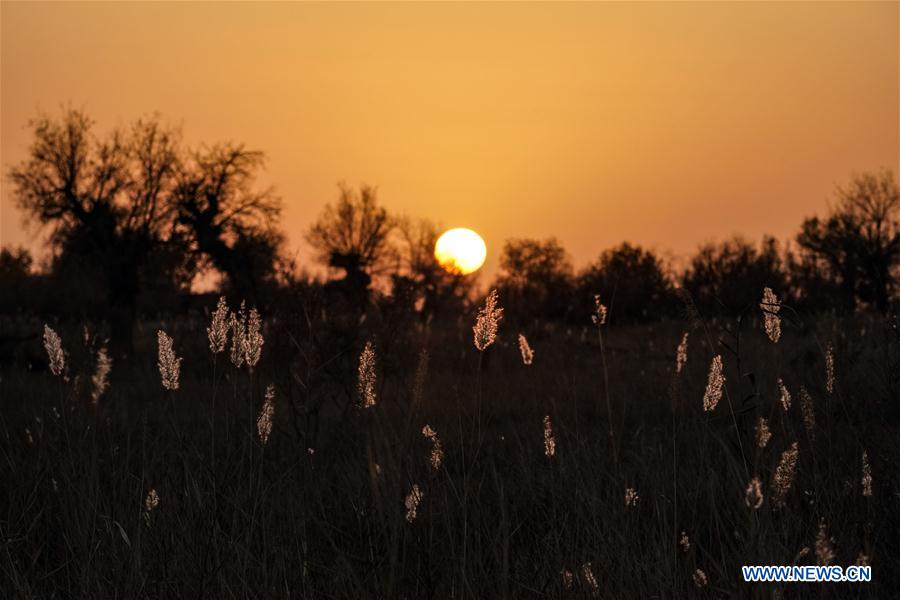
hoto taken on Nov. 10, 2019 shows reeds at sunset by the Keriya river in northwest China's Xinjiang Uygur Autonomous Region. The Keriya river originates from the Kunlun mountains, flows north through Yutian County in Xinjiang, and ends in the Taklimakan desert. (Xinhua/Shen Bohan)
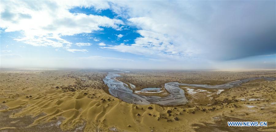
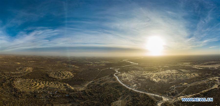
An aerial panoramic photo taken on Nov. 18, 2019 shows the Keriya river in northwest China's Xinjiang Uygur Autonomous Region. The Keriya river originates from the Kunlun mountains, flows north through Yutian County in Xinjiang, and ends in the Taklimakan desert. (Xinhua/Shen Bohan)
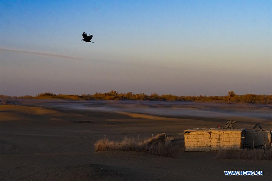
Photo taken on Nov. 13, 2019 shows a traditional residence at an oasis by the Keriya river in northwest China's Xinjiang Uygur Autonomous Region. The Keriya river originates from the Kunlun mountains, flows north through Yutian County in Xinjiang, and ends in the Taklimakan desert. (Xinhua/Shen Bohan)
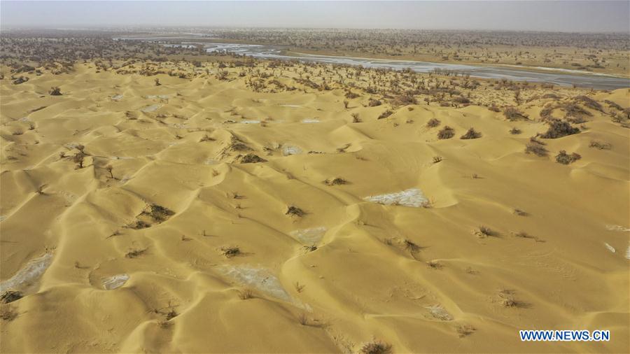
Aerial photo taken on Nov. 18, 2019 shows dunes by the Keriya river in northwest China's Xinjiang Uygur Autonomous Region. The Keriya river originates from the Kunlun mountains, flows north through Yutian County in Xinjiang, and ends in the Taklimakan desert. (Xinhua/Hu Huhu)
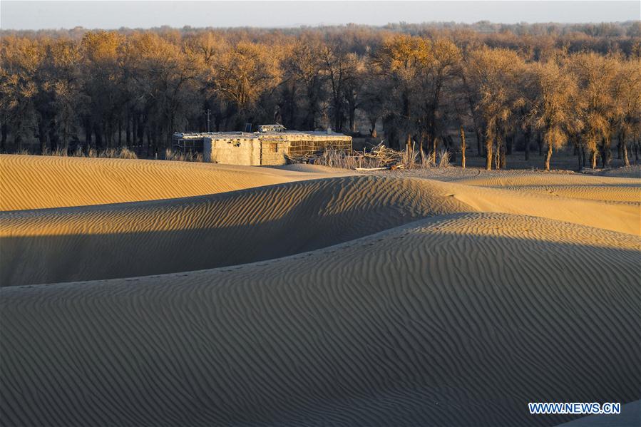
Photo taken on Nov. 13, 2019 shows a residence located near the end of the Keriya river in northwest China's Xinjiang Uygur Autonomous Region. The Keriya river originates from the Kunlun mountains, flows north through Yutian County in Xinjiang, and ends in the Taklimakan desert. (Xinhua/Hu Huhu)
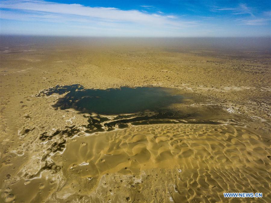
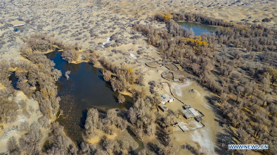
Aerial photo taken on Nov. 16, 2019 shows a lake by the Keriya river in northwest China's Xinjiang Uygur Autonomous Region. The Keriya river originates from the Kunlun mountains, flows north through Yutian County in Xinjiang, and ends in the Taklimakan desert. (Xinhua/Shen Bohan)
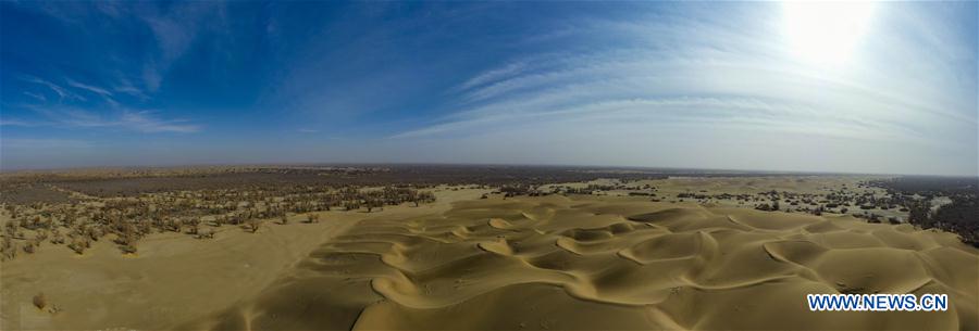
An aerial panoramic photo taken on Nov. 16, 2019 shows dunes by the Keriya river in northwest China's Xinjiang Uygur Autonomous Region. The Keriya river originates from the Kunlun mountains, flows north through Yutian County in Xinjiang, and ends in the Taklimakan desert. (Xinhua/Hu Huhu)
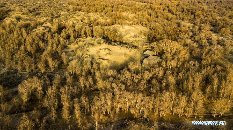
Aerial photo taken on Nov. 17, 2019 shows traditional residences amid a desert poplar (populus euphratica) forest at an oasis by the Keriya river in northwest China's Xinjiang Uygur Autonomous Region. The Keriya river originates from the Kunlun mountains, flows north through Yutian County in Xinjiang, and ends in the Taklimakan desert. (Xinhua/Shen Bohan)
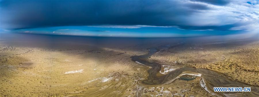
An aerial panoramic photo taken on Nov. 18, 2019 shows the Keriya river in northwest China's Xinjiang Uygur Autonomous Region. The Keriya river originates from the Kunlun mountains, flows north through Yutian County in Xinjiang, and ends in the Taklimakan desert. (Xinhua/Shen Bohan)
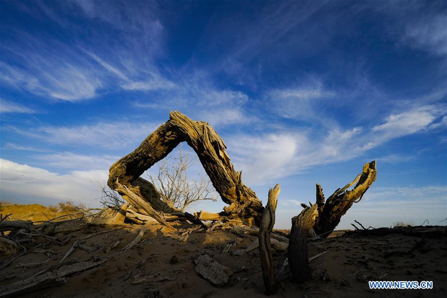
Photo taken on Nov. 15, 2019 shows a fallen desert poplar (populus euphratica) by the Keriya river in northwest China's Xinjiang Uygur Autonomous Region. The Keriya river originates from the Kunlun mountains, flows north through Yutian County in Xinjiang, and ends in the Taklimakan desert. (Xinhua/Shen Bohan)
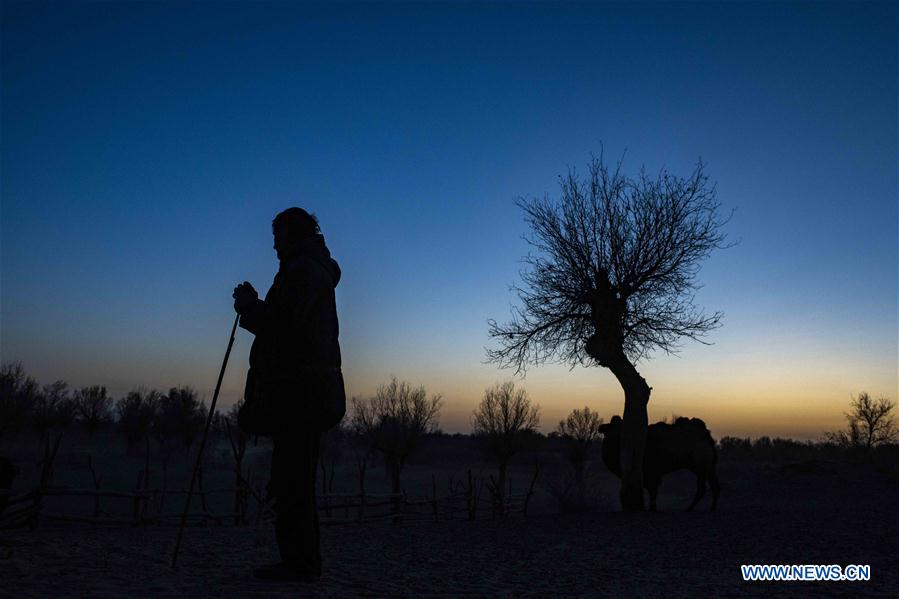
A herdsman walks past a desert poplar (populus euphratica) by the Keriya river in northwest China's Xinjiang Uygur Autonomous Region, on Nov. 14, 2019. The Keriya river originates from the Kunlun mountains, flows north through Yutian County in Xinjiang, and ends in the Taklimakan desert. (Xinhua/Hu Huhu)
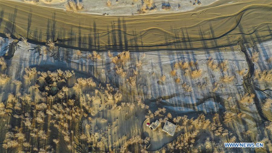
Aerial photo taken on Nov. 16, 2019 shows a residence by the Keriya river in northwest China's Xinjiang Uygur Autonomous Region. The Keriya river originates from the Kunlun mountains, flows north through Yutian County in Xinjiang, and ends in the Taklimakan desert. (Xinhua/Hu Huhu)
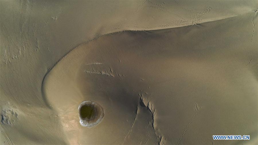
Aerial photo taken on Nov. 16, 2019 shows a dune by the Keriya river in northwest China's Xinjiang Uygur Autonomous Region. The Keriya river originates from the Kunlun mountains, flows north through Yutian County in Xinjiang, and ends in the Taklimakan desert. (Xinhua/Hu Huhu)
Aerial photo taken on Nov. 16, 2019 shows desert poplars (populus euphratica) and residences by the Keriya river in northwest China's Xinjiang Uygur Autonomous Region. The Keriya river originates from the Kunlun mountains, flows north through Yutian County in Xinjiang, and ends in the Taklimakan desert. (Xinhua/Hu Huhu)
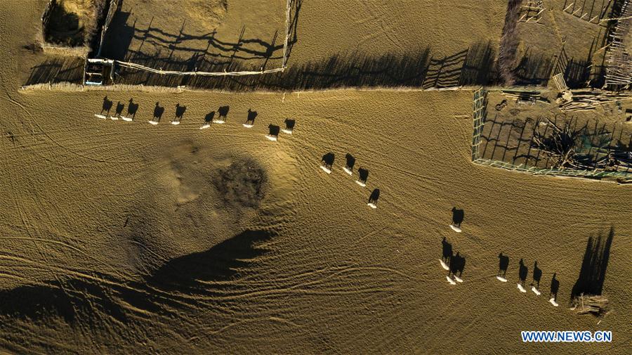
Aerial photo taken on Nov. 13, 2019 shows a herd of sheep at an oasis by the Keriya river in northwest China's Xinjiang Uygur Autonomous Region. The Keriya river originates from the Kunlun mountains, flows north through Yutian County in Xinjiang, and ends in the Taklimakan desert. (Xinhua/Shen Bohan)
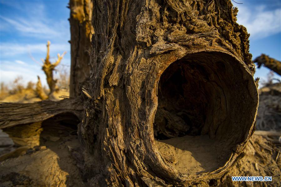
Photo taken on Nov. 15, 2019 shows a desert poplar (populus euphratica) by the Keriya river in northwest China's Xinjiang Uygur Autonomous Region. The Keriya river originates from the Kunlun mountains, flows north through Yutian County in Xinjiang, and ends in the Taklimakan desert. (Xinhua/Hu Huhu)
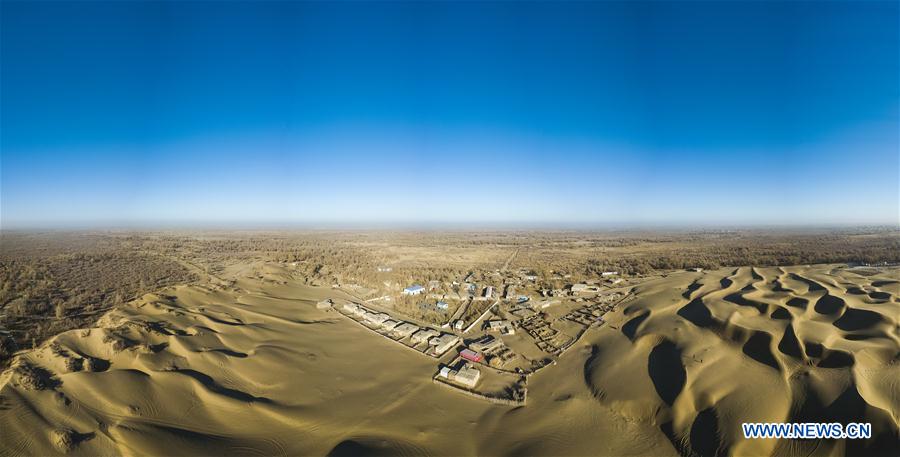
An aerial panoramic photo taken on Nov. 13, 2019 shows a view of an oasis by the Keriya river in northwest China's Xinjiang Uygur Autonomous Region. The Keriya river originates from the Kunlun mountains, flows north through Yutian County in Xinjiang, and ends in the Taklimakan desert. (Xinhua/Shen Bohan)
An aerial panoramic photo taken on Nov. 13, 2019 shows desert poplar (populus euphratica) forests by the Keriya river in northwest China's Xinjiang Uygur Autonomous Region. The Keriya river originates from the Kunlun mountains, flows north through Yutian County in Xinjiang, and ends in the Taklimakan desert. (Xinhua/Shen Bohan)