

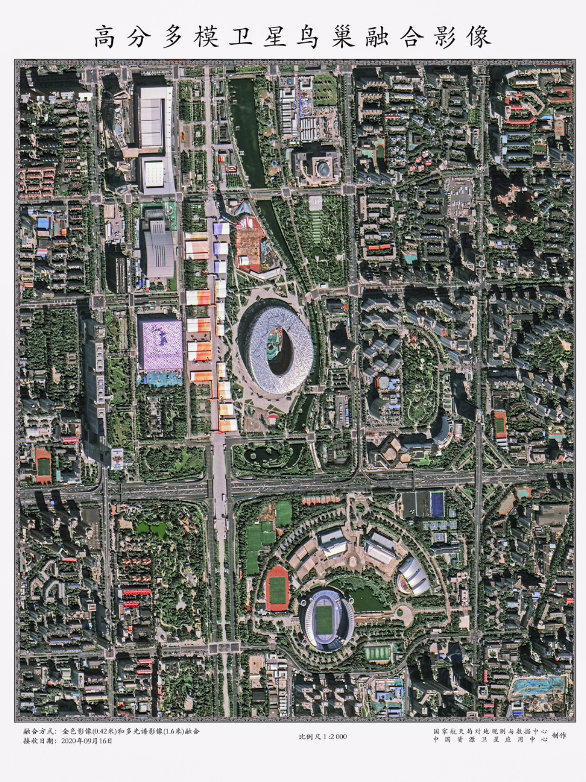
GFDM fusion image of Beijing National Stadium (Photos: China National Space Administration)
The China National Space Administration on Tuesday released about 20 sub-meter level 3D images returned from the high-resolution multi-mode integrated imaging satellites, or GFDM. China’s landmark images of various regions were shared, including Beijing, Jiayuguan, Gezhouba Dam, and the four cities in eastern Inner Mongolia.
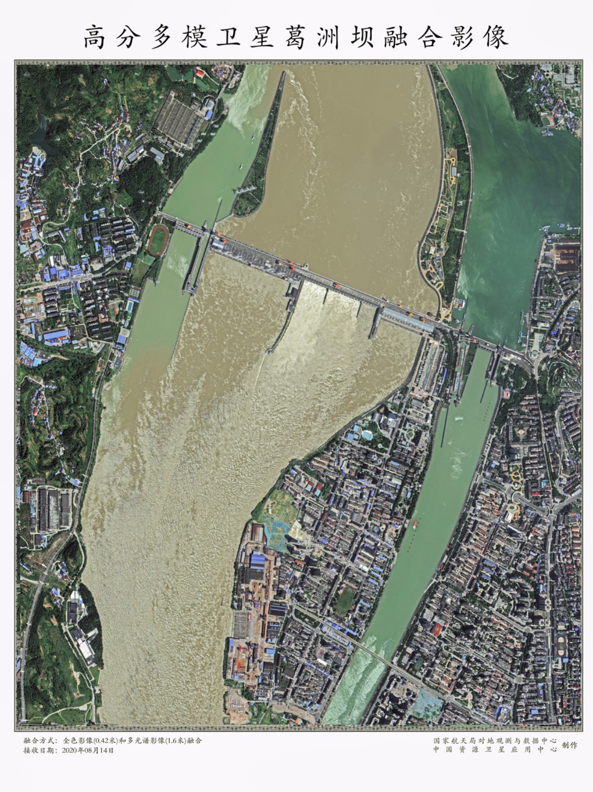
GFDM fusion image of Gezhouba Dam on the Yangtze River
Taking geographical distribution, land features and the surveying demands of main users into account, the images reflect the high-resolution and high-radiation advantages of satellite imaging.
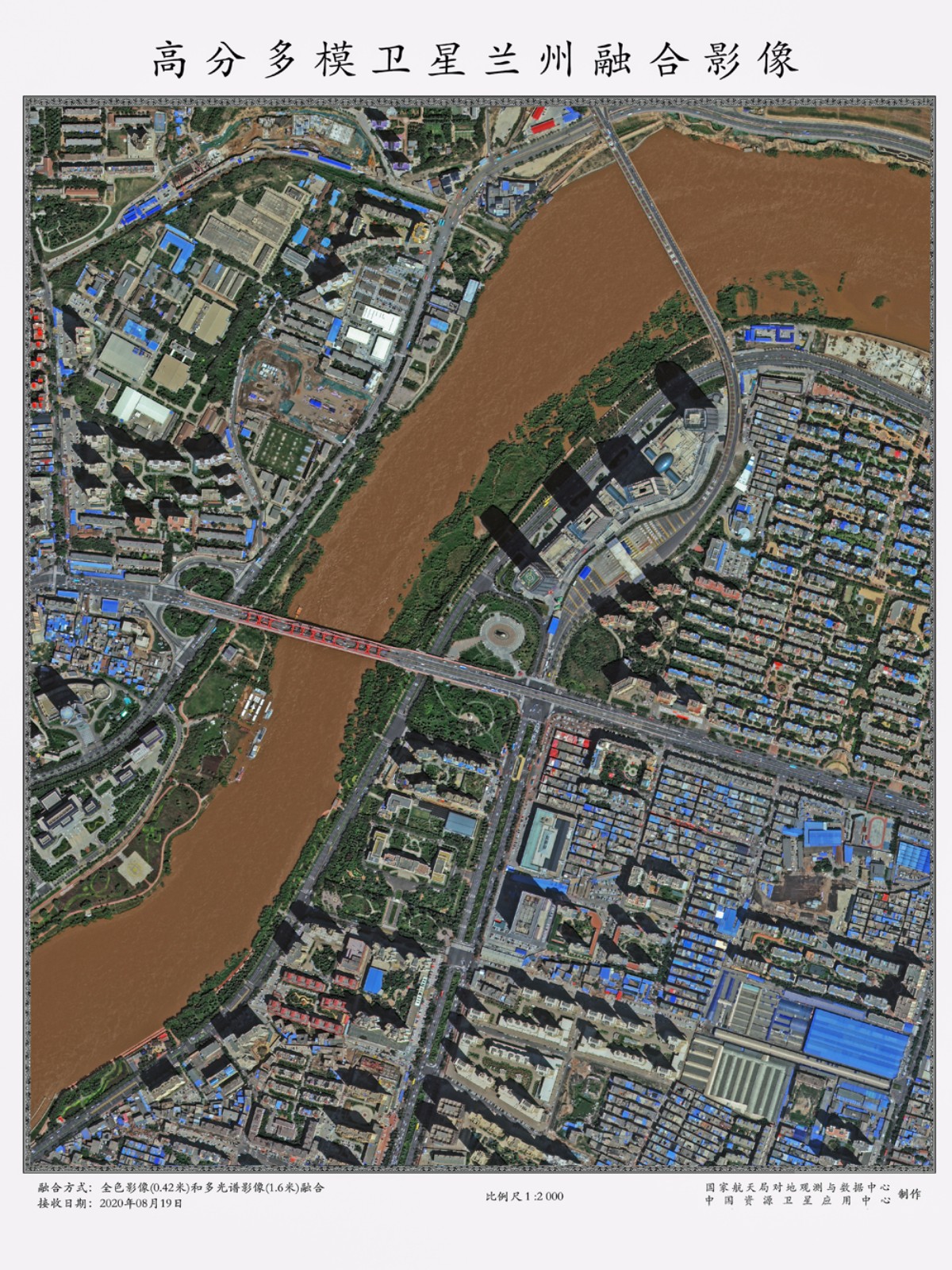
GFDM fusion image of northwestern Lanzhou
Supported by government users such as the Ministry of Natural Resources and led by the China National Space Administration, the imaging products were produced by the China Center for Resource Satellite Data and Applications (CRESDA).
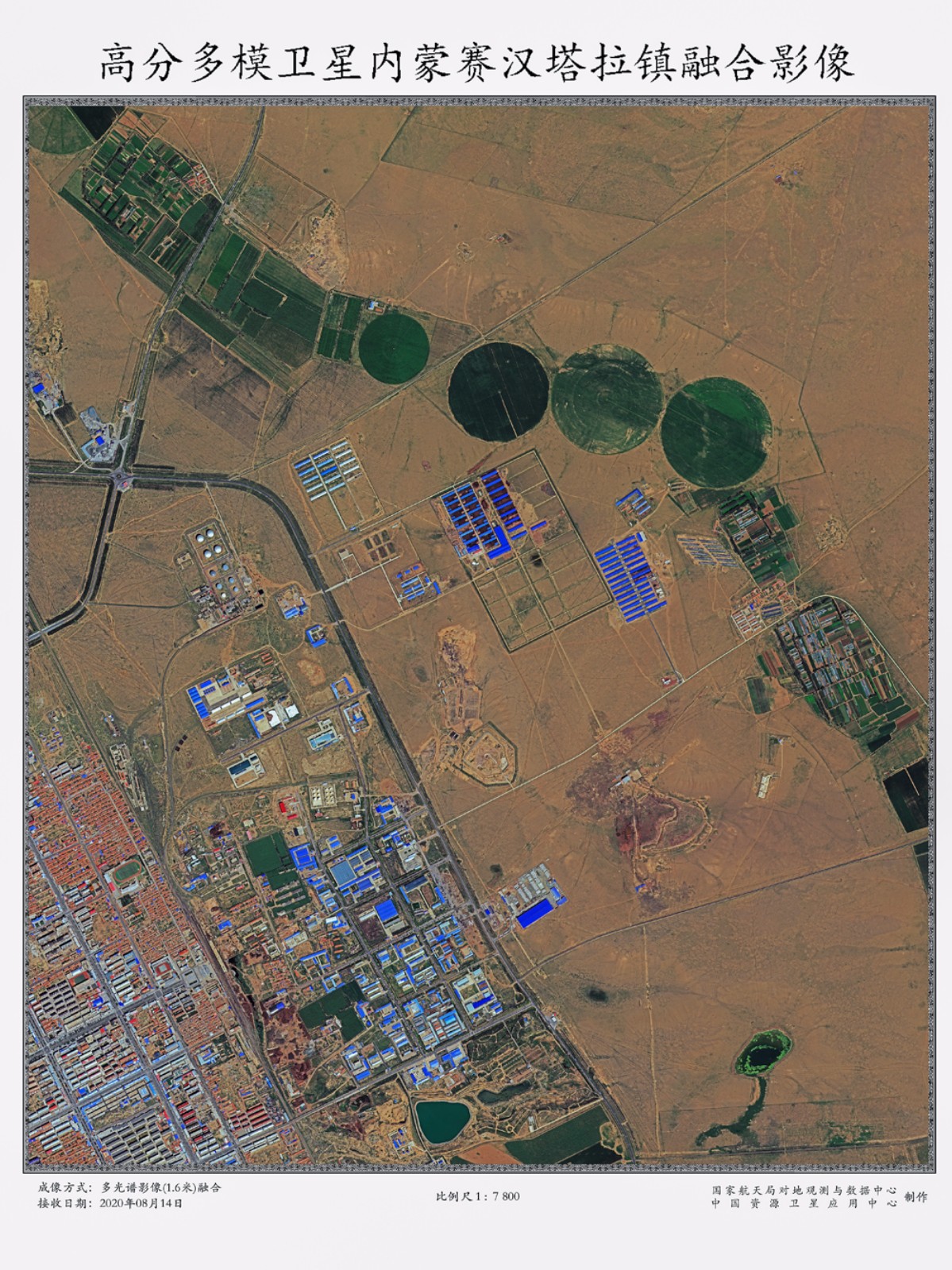
GFDM fusion image of Saihan Tala, a small town in Inner Mongolia
The GFDM is China's first optical remote sensing satellite featuring a sub-meter civilian resolution and multiple agile imaging modes. Initiated in 2018, it was launched at the Taiyuan Satellite Launch Center in north China's Shanxi Province on July 3. The launch also shows world-leading standards of China’s optical remote sensing satellites.
(Compiled by Luo Dantong)