


Nepal plans flood early warning systems in river basins, risk reduction in glacial lakes
The Nepali government has unveiled plans to expand flood early warning systems across six major river basins and lower water levels in four high-risk glacial lakes as part of efforts to strengthen disaster preparedness amid growing climate-related risks in the Himalayan region.
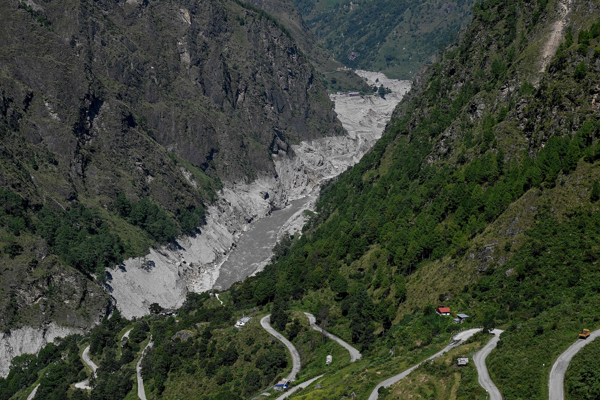
The Nepal-China Highway near the Bhote Koshi River in Syabrubesi, Nepal's Rasuwa district, September 29, 2026. (Photo: VCG)
The initiatives are part of a broader strategy to improve flood forecasting, reduce the risk of glacial lake outburst floods (GLOFs) and modernize weather forecasting through advanced technologies, according to separate documents issued by the Center for Hydrology and Water Resources Research and the Department of Hydrology and Meteorology, the secretariat of Nepal's Ministry of Energy, Water Resources and Irrigation said in a press statement on Sunday.
The plans come in the wake of devastating floods on August 26 that claimed around 1,500 lives while more than 5,000 people remain missing. The floods also caused $1.81 billion in physical damage, according to the Nepali government's preliminary Rapid Damage and Needs Assessment (RDNA).
Rising temperatures have accelerated glacier melting in the Himalayas, increasing concerns over glacial lake instability, avalanches and potentially destructive floods downstream.
Under the proposed Glacial Lake Outburst Flood (GLOF) Sanjeevani Project, the government plans to lower water levels in four high-risk glacial lakes: Thulagi in Manang district, Lower Barun in Sankhuwasabha district, and Lumding Tsho and Hongu-2 in Solukhumbu district.
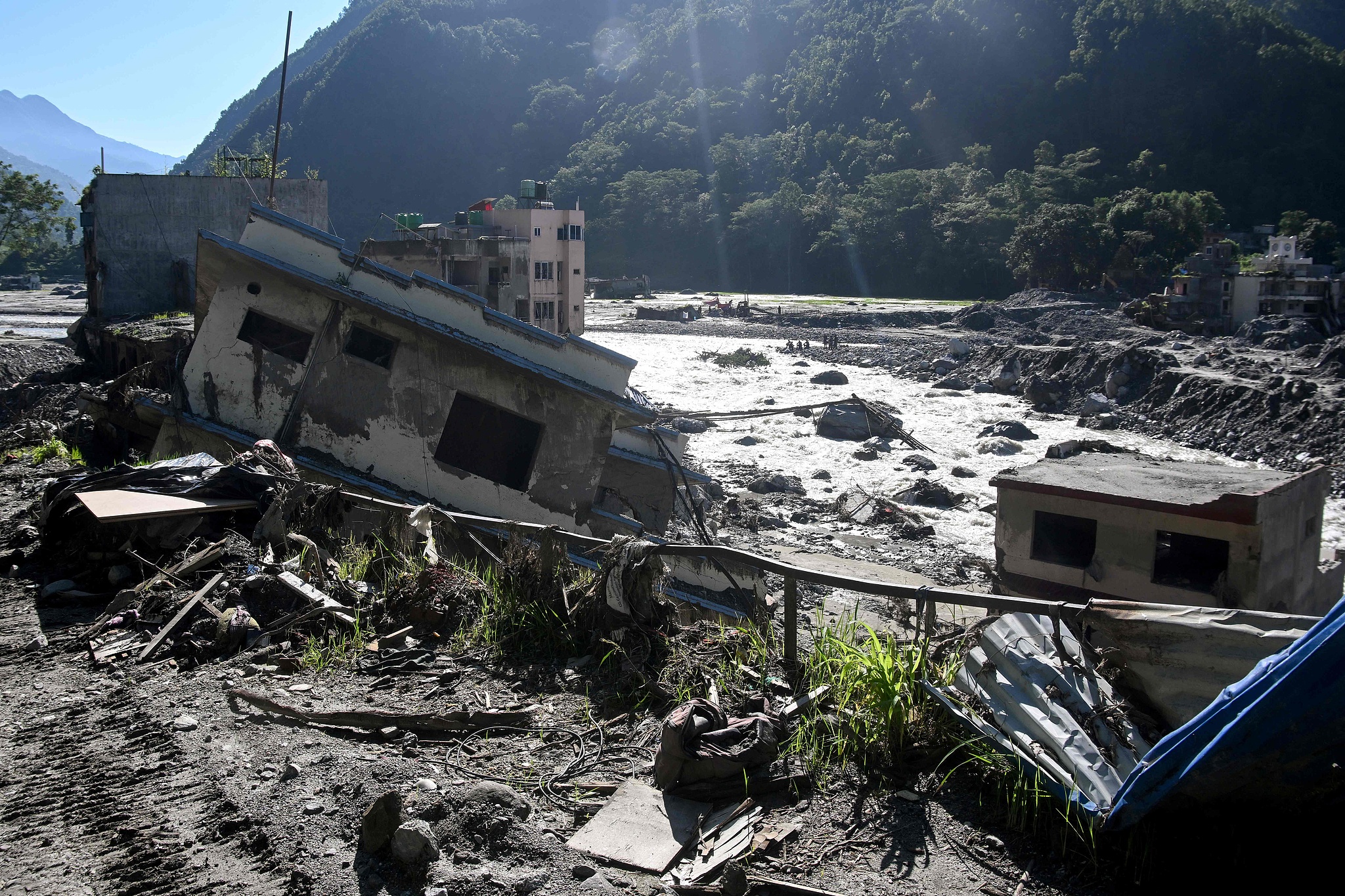
Damaged houses covered in sludge remain after the August 26 flash flood in Betrawati Bazaar, Nepal's Rasuwa district, September 28, 2026. (Photo: VCG)
The project is scheduled to run from 2026 to 2033, with an estimated budget of $49.9 million.
The initiative builds on previous efforts to reduce risks at Tsho Rolpa in Dolakha district and Imja Lake in Solukhumbu district, where water levels were successfully lowered to mitigate the threat of glacial lake outburst floods.
Meanwhile, the Center for Hydrology and Water Resources Research plans to install flood early warning systems across six river basins under the Priority River Basins Flood Risk Management Project, which runs from 2022 to 2028, with an investment of $7.54 million.
The center will also provide round-the-clock flood forecasting and early warning services from mid-May to mid-October, covering the country's main monsoon season.
In a separate initiative to improve weather forecasting, the Department of Hydrology and Meteorology plans to prioritize artificial intelligence, machine learning and high-performance computing systems to enhance the accuracy and reliability of forecasts.