

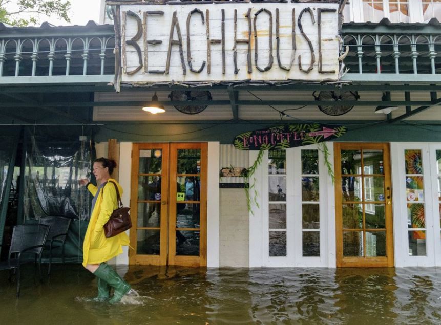
Aimee Cutter, the owner of Beach House restaurant, walks through water surge from Lake Pontchartrain on Lakeshore Drive in Mandeville, La., ahead of Tropical Storm Barry, Saturday, July 13, 2019. (Photo: AP)
Carrying “off the chart” amounts of moisture, Barry crawled ashore Saturday in Louisiana and quickly weakened to a tropical storm that promised to dump heavy rains that could last for days and pose a test of the flood-prevention systems built after Hurricane Katrina 14 years ago.
The storm made landfall near Intracoastal City, Louisiana, about 160 miles west of New Orleans, and its winds fell to 70 mph, the National Hurricane Center said.
The Coast Guard rescued more than a dozen people from the remote Isle de Jean Charles, south of New Orleans, where water rose so high that some residents clung to rooftops. But in the city, locals and tourists wandered through mostly empty streets under a light rain or stayed indoors.
Video showed water overtopping a levee in Plaquemines Parish south of New Orleans, where fingers of land extend deep into the Gulf of Mexico. Officials were still confident that the levees would hold firm.
More than 70,000 customers were without power Saturday morning, including 66,830 in Louisiana and 3,140 in Mississippi, according to poweroutage.us.
Barry had strengthened into a Category 1 hurricane by Saturday morning, with maximum sustained winds of 75 mph (120 kph), the National Hurricane Center said. Storms become hurricanes when their winds reach 74 mph (120 kph) or higher. Barry was expected to weaken again after reaching land and become a tropical depression on Sunday.
Officials predicted the hurricane would make landfall near Morgan City, west of New Orleans. The small town had an overnight curfew that expired Saturday morning, after on-and-off rain and power outages. People used cellphones to see in the dark, and opened doors and windows to let the warm, sticky tropical air circulate.
Though expected to be a weak hurricane, Barry threatened disastrous flooding across a swath of the Gulf Coast. By Saturday morning, the storm system had gathered a “big slough of moisture,” meaning “a lot of rain is on the way,” said National Hurricane Center Director Ken Graham. During a storm update through Facebook Live, Graham pointed to a computer screen showing a huge, swirling mess of airborne water. “That is just an amazing amount of moisture,” he said. “That is off the chart.”
The rains inundated the remote Isle de Jean Charles, about 45 miles (72 kilometers) south of New Orleans. Coast Guard rescuers used helicopters to pluck some residents from rooftops and loaded others into boats from flooded homes on Saturday morning, Petty Officer Lexie Preston said.
The downpours were also lashing coastal Alabama and Mississippi. Parts of Dauphin Island, a barrier island in Alabama 200 miles (322 kilometers) away from where Barry was headed, were flooded both by rain and surging water from the Gulf, said Mayor Jeff Collier, who was driving around in a Humvee to survey damage. He said the island still had power early Saturday afternoon and wind damage was minimal. The island is often affected by far-away storms, he said.
Water was flowing over a “back levee” in Point Celeste in Plaquemines Parish, officials said in an automated telephone recording distributed to residents. The levee was not on the Mississippi River and there was no indication that the barrier was breached or broken or that major flooding was occurring, the recording said.
Officials said they were worried the water could close Highway 23, cutting off a key road and the rest of the parish to the south. Much of Plaquemines Parish had been under an evacuation order since Thursday.
Barry was moving so slowly, it was likely that heavy rain would continue throughout the weekend, Graham said. There were predictions of 10 to 20 inches (25 to 50 centimeters) of rain through Sunday across a swath of Louisiana that includes New Orleans and Baton Rouge, with some parts of the state possibly getting 25 inches (63 centimeters). Looking ahead, tracking forecasts showed the storm moving toward Chicago, swelling the Mississippi River basin with water that must eventually flow south again.
Governors declared emergencies in Louisiana and Mississippi, and authorities took unprecedented precautions in closing floodgates and raising the barriers around New Orleans. Louisiana Gov. John Bel Edwards said it was the first time all floodgates were sealed in the New Orleans-area since Katrina. Still, he said he didn’t expect the Mississippi River to spill over the levees despite water levels already running high from spring rains and melting snow upstream. The barriers range in height from about 20 feet to 25 feet (6 meters to 7.5 meters).
There was one piece of good news: Late Friday night, forecasters said the Mississippi River was expected to crest in New Orleans at about 17.1 feet (5.2 meters) on Monday, not 19 feet (5.8 meters) as had been earlier predicted. The levees protecting the city range from about 20 to 25 feet (6 to 7.5 meters) in height.
Authorities told at least 10,000 people in exposed, low-lying areas along the Gulf Coast to leave, but no evacuations were ordered in New Orleans, where officials urged residents to “shelter in place.” On-again, off again rain hit the city overnight. Early Saturday, streets in the normally raucous French Quarter tourist district were largely empty and barely damp.
“It’s moving really slowly,” said New Orleans Councilwoman Helena Moreno. “Because of that, there is concern it could be building as it just sits over the water. ... We could feel a bigger impact.”