(Photo: NASA)
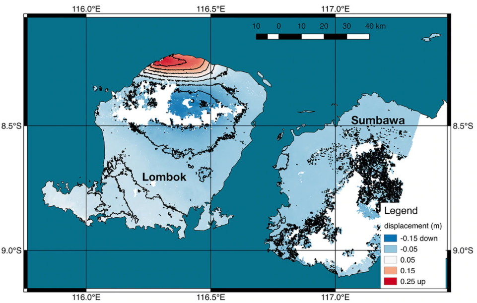
The continuous earthquakes in Lombok, Indonesia, have changed Indonesia’s landscape. The northwest coast of Lombok Island was raised about 10 inches (25 centimeters), according satellite map released by NASA on Wednesday.
NASA used new satellite images taken from July 30 to August 5 to produce a map of ground deformation on the resort island of Lombok following Sunday’s deadly earthquake.
Scientists found that the earthquake caused plates to slip on a fault beneath the northwestern part of Lombok Island, causing 25 centimeters uplift of the ground surface.
The map shows the amount of permanent surface movement in Lombok Island, almost entirely due to the quake.
NASA and its partners are contributing important observations and expertise that can help respond to earthquakes and other natural or human-produced hazards through these maps.
Three earthquakes occurred in Lombok, Indonesia, over the last two weeks. A 6.4-magnitude earthquake occurred in Lombok on July 29. A 7.0-magnitude earthquake occurred in the northern part of Lombok on August 5, causing hundreds of people’s deaths and thousands of injuries. A 6.2-magnitude earthquake jolted Lombok Island on Thursday, from a depth of 12 kilometers.


